


The states from the Colorado River’s Upper and Lower basins released proposals Wednesday for curbing their river water use that are as different as their respective climates when it comes to who takes the cuts.
The less populous, four Upper Basin states proposed cutting river water use by Arizona and the other two Lower Basin states, California and Nevada, by up to 20% in most years and more in drier years over the next decade.
The Upper Basin plan didn’t offer any specific mandatory cuts for its states of Colorado, New Mexico, Utah and Wyoming. It held out the possibility of an undefined amount of voluntary cuts under certain conditions but said those would be carried out separate from the federal environmental review process under which the two basins’ plans will now be considered by the U.S. Bureau of Reclamation.
Later Wednesday, the Lower Basin states, which have the overwhelming majority of the basins’ residents, unveiled their proposal. It also calls for gradually stiffening cuts. Its representatives say these cuts are by far the biggest discussed since the river started steadily losing flows right after the turn of the 21st century.
The Lower Basin proposal calls for what its water leaders say is “shared sacrifice” between Upper and Lower basin states. Its plan would start with cuts only for Lower Basin states but would add Upper Basin cuts as river reservoir levels continue dropping.
The competing proposals are certain to continue the standoff that has persisted for some time now between representatives of the two basins.
The Lower Basin states’ representatives, including Arizona Department of Water Resources Director Tom Buschatzke, have said repeatedly they can’t support a proposal under which they would have to bear the entire burden of any cuts aimed at bringing water use on the river in line with its limited and gradually shrinking supplies.
At Wednesday’s briefing, their representatives said an Upper Basin states’ stance of not taking any cuts is inviting litigation — an outcome all parties have said they wish to avoid.
“We believe our alternative is considerate of (Colorado River) compact requirements, adjusts for hydrologic shortages, and is considering of our Upper Basin partners,” said John Entsminger, general manager of the Southern Nevada Water Authority.
Upper Basin states have said, however, that they’re already losing about a million acre-feet a year in what they call natural shortages, in which less water flows down tributaries to the Colorado than their urban and agriculture users have come to depend on.
They also note that they’re taking much less water from the river than they have a right to take. Moreover, Lower Basin states often take out more than their legal share of the river if evaporation along the Lower Colorado River downstream of Lake Mead is taken into account.
Last year, however, the Lower Basin states took out only 5.8 million out of a total share of 7.5 million acre-feet from the Colorado, although part of that was due to 2023’s extremely wet and snowy weather.
Both basins are sending their own water-saving plans to the Reclamation because they’ve been unable to agree on a joint plan. The bureau wants to study proposed plans in a forthcoming environmental review. Following that review, the federal agency and the states want to agree on new operating guidelines for the river to replace existing guidelines that expire at the end of 2026.
Asked by a reporter how the Upper and Lower Basin states can resolve their widely different proposals, Arizona’s Buschatzke said, “The Upper Basin proposal, and I have not fleshed it out, I saw it an hour or so ago, puts entire burden of protecting the river system on the Lower Basin. There are no reductions in any circumstances from the Upper basin. What I need to see is that they contribute to river system (with a plan) that has certainty. Our proposal results in reductions that will be forceful. We need to see that from the Upper Basin.”
The Upper Basin states' water officials held no media briefing and confined their comments on their new plan to statements in a news release about it. Their comments didn't discuss their differences with the Lower Basin states other than to say they still hope to resolve them through eventual agreement on a seven-state plan.
“We can no longer accept the status quo of Colorado River operations,” said Becky Mitchell, Colorado’s Commissioner to the Upper Colorado River Commission. “If we want to protect the system and ensure certainty for the 40 million people who rely on this water source, then we need to address the existing imbalance between supply and demand.
"That means using the best available science to work within reality and the actual conditions of Lake Powell and Lake Mead. We must plan for the river we have - not the river we dream for.”
Estevan Lopez, New Mexico's Colorado River Commissioner, said, “The Colorado River Basin is at a critical juncture. The (Upper Basin) alternative seeks to acknowledge the Upper Basin’s realities, including hydrologic shortages, protect Upper Basin interests, and contribute towards future sustainability of the entire basin.
"We look forward to working with our sister Lower Basin States to resolve differences in approach and create a 7-state consensus alternative.”
When cuts would kick in
Specifically, the Lower Basin plan would tie its proposed water use reductions to the levels of water at seven reservoirs in the two basins, not just at Lakes Powell and Mead.
At their briefing today, the Lower Basin states hailed this proposal as a groundbreaking effort to tie the issue of water uses in the river to the entire system’s health, not just at Powell and Mead.
If those two large reservoirs are at least 70% full, no cuts would be necessary under the Lower Basin proposal. That scenario is highly unlikely in the foreseeable future, however, because the reservoirs have been nowhere near that close to capacity in many years.
With reservoir levels ranging from 59% to 69% full, the Lower Basin only would be required to make anywhere from 0 to 1.5 million acre-feet a year in cuts. The higher number represents about 15 years worth of total water use by Tucson Water’s customers.
With the reservoirs at 39% to 58% of capacity, the Lower Basin would cut use by a flat 1.5 million acre-feet a year. That cut would essentially wipe out the structural deficit between water use and supply that all parties agree has been built into the overall river system for many decades, even in good years on the river when snowpack and runoff are high.
Once the reservoir system drops to 38% of capacity, all seven basin states would have to make cuts. The Upper Basin states would be on the hook for half the cuts taken beyond that point.
“That is where we think the entire basin needs to be on deck — every water user in the seven states and two countries (U.S. and Mexico) needs to be part of the solution,” Entsminger said at the briefing.
Arizona and California have agreed on how the cuts would be split between those two states when the reservoir system is at least 39% full. At that level of available reservoir supplies, Arizona would swallow 760,000 acre-feet of cuts, annually, California would take 440,000, Nevada would take 50,000 and Mexico would be asked to take 250,000. The state water officials said Wednesday, however, that Mexico would also have to agree to whatever water use curbs it’s going to take.
Once the reservoir system drops to 38% of capacity, the cut would range from 1.5 million acre-feet to 3.9 million acre-feet a year, depending on how depleted the reservoir system is. The Lower Basin’s plan doesn’t, however, say how such deeper cuts would be shared between the two basins, let alone how they would be shared among the various states within those basins. That means, for instance, that the plan doesn’t spell out how the deeper cuts would be split between Arizona and California.
These cuts would gradually tighten until the reservoirs fall below 23% of capacity. At that point, the states would have to take maximum reductions of 3.9 million acre-feet a year.
“Our overall goal is a long-term plan.” Entsminger said, adding these states want to create a system that lasts until the 2060s or 2070s.
The Upper Basin proposal, while also containing a series of gradually tightening water use reductions, would tie them totally to elevations at Lakes Powell and Mead. Releases of water from Powell and Mead also would be tied to elevations at the two declining reservoirs.
Cuts in releases from Mead would be immediately felt by the Lower Basin states whose cities and farms depend on Mead for their water supplies. Cuts in releases from Powell would give Mead less water, requiring future cuts in releases from Mead.
Nearly two years ago, Reclamation Commissioner Camille Touton stunned many observers by telling the states to cut their water use by 2 million to 4 million acre-feet a year.
Since then, Mead and Powell’s elevations have risen significantly due to a wet winter last year.
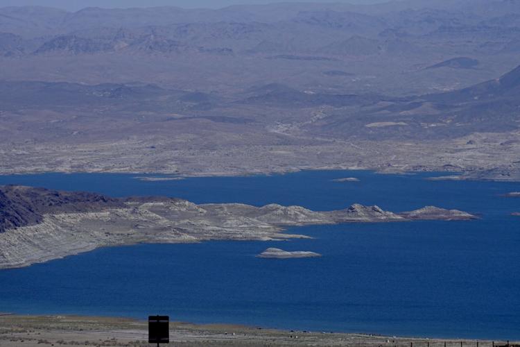
As of Tuesday, Mead was 37% full and Powell was 34% full. That’s significantly fuller than the reservoirs stood a year or two ago, but still far lower than state and federal water officials would like them to be.
Mead, Powell cuts
Specifically for Lake Mead, the Upper basin states proposed that:
— If Mead is at least 90% full, the Lower Basin states would take no cuts in their supplies.
— If Mead is between 70% and 90% full, the Lower Basin states would lose up to 1.5 million acre-feet per year.
— If Mead is 20% to 70% full, Lower Basin states would lose 1.5 million acre feet a year.
— If Mead is 20% full or lower, Lower Basin states would have to take cuts of up to 2.4 million acre-feet on top of the 1.5 million they’re already taking.
For Lake Powell, the Upper Basin states proposed a series of shrinking water releases depending on the lake’s elevation:
— If Powell is 81% to 100% full, the lake will release anywhere from 8.1 to 9 million acre-feet of water annually to send to Lake Mead for use by Lower Basin states.
— If Powell stands anywhere from 20% of 81% full, the lake will release somewhere between 6 million and 8.1 million acre-feet a year to Mead.
— If Powell is less than 20% full, it will send to Mead 6 million acre-feet a year.
Under federal law, the Upper Basin states are legally required to release at least 75 million acre-feet of water over 10 years. The Upper and Lower Basin states disagree over whether an additional 7.5 million acre feet of releases is also required, to satisfy U.S. treaty obligations to deliver river water to Mexico.
Beyond these proposals, the Upper Basin states say they will take “parallel actions” when feasible to help preserve the river’s flows, and to prop up Lake Powell. These measures include what the states called potential releases of water from several dams lying upstream of Lake Powell to raise Powell’s water levels, to help preserve the ability to release water from Powell.
The states will also pursue “voluntary, temporary and compensated reductions” of river water use — with amounts based on “multiple factors, including hydrologic conditions,” the Upper Basin states said.

