


There is a place in Baja Arizona that rests in my memory and daydreams, more as a passage than an arrival to a specified destination. A confluence of history, cultures, landscapes, biomes and folklore. It is as much defined by the roads, trails and stories that lead you from the Tucson basin into the valleys and high desert grasslands of the Madrean Archipelago.
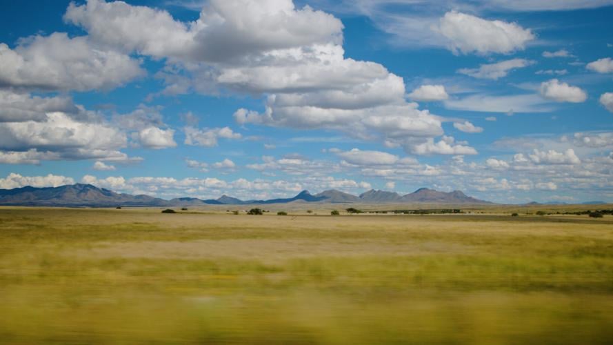
The grasses tell the stories of the seasons, from greens of summer, to velvety golden hues of fall, to a shimmering silver through winter. For most of the year, a warm golden hue blankets the land against the crisp blue of the desert sky.
As you traverse the 80-plus miles, you wind through a two-lane road in the valley between the Santa Rita and Whetstone mountains on your way to Sonoita. The twists and turns unfold views that still inspire as much as the first time one lays eyes upon them, the subtle gain in elevation and changing landscape evoking memories and emotions untethered to this place.
Once in Sonoita, there are a few ways to get to the San Rafael Valley. Continue straight through the stop sign, and you find yourself winding through Southern Arizona’s wine country, a legacy of viticulture in the region since the Spanish missionaries. As you move farther south, you move with a slower pace, snaking through the Canelo Hills, an old, eroded range, remnant of an ancient Caldera. Its supple curves and shapes softer to the eye than its younger mountain formations in the region. At one point on the path, you can see as far as New Mexico some 200 miles east, and every mountain range that form the basins of the region. I can start to imagine the peoples and wildlife for ages, moving with the soft grade of the land towards water, the San Pedro River valley to the east, and towards the climax of this journey which culminates at Canelo Pass with a view over the whole of the San Rafael Valley.
The road drops into the bowl that feeds the headwaters of the Santa Cruz river, flowing directly south into Sonora, Mexico, about 10 miles as the crow flies before it meanders and turns back north down the next valley to Tucson. The valley is held by the Canelo Hills to the north and northeast, Patagonia Mountains to the west, and the Huachuca Mountains in the east.
Back at the Sonoita stop sign, you may also choose to turn right towards the town of Patagonia. From the running waters of Sonoita Creek, Harshaw Creek, one can slow time under the giggling of the cottonwoods. Visit local favorites like Judith Chafee’s visitor center and the trails at Nature Conservancy’s Patagonia Sonoita Creek Preserve, or the sanctuary at Tucson Audubon’s Paton Center for Hummingbirds. It is worth a stop by for a bite and drink at the Wagon Wheel Saloon, the local bar where the likes of Jim Harrison and Charles Bowden may have traded stories of the border, and modern folklore.
From town you head another 15 miles east, slowly moving through the mineral rich Patagonia Mountains, whose canyons and ancient sycamores can speak to the layers of a cultural past that has spanned a millennium. As you move through this cultural and geologic time written in the landscape, the road rises out of a canyon and breaks the ridge at the western edge of the San Rafael Valley. I am immediately taken by the beauty and expanse of the grass, flowing over horizons as the time and the place seem to merge under the sky into a familiar, yet evolving frontier.
Do you know Arizona's state bird or its state mammal? Take this quiz and see how you do. Video by Johanna Eubank, Arizona Daily Star

