

March blew out like a lion as yet another storm passed to our north, bringing wind, lower temperatures and a rumor of rain.
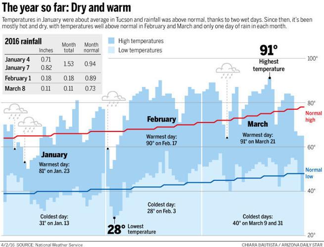
Alas, it was just a rumor. It rained one day out of 31 in March — a paltry 0.11 of an inch on March 8. Normally, Tucson receives 0.73 inches for the month.
And March followed a dry February, which had 28 rainless days following the last good semi-soaking of 0.18 of an inch Feb. 1. January was wetter, with two days of rain for a combined 1.53 inches.
That’s it. Four days of rain for the entire year, leaving Tucson 0.74 of an inch below its normal precipitation tally of 2.56 inches.
So what happened to that prediction of a wetter-than-normal winter caused by El Niño’s warming of the Pacific Ocean?
It was a hope, not a prediction.
What the weather forecasters told us was that a strong El Niño event usually corresponds with increased winter precipitation in the Southwest.
That’s based on increased rainfall during the six strongest events on record. Climate models backed that up, but they, too, were missing something.
Measurement of the El Niño-Southern Oscillation dates only to 1950, said University of Arizona climatologist Mike Crimmins.
“In climate-speak, we don’t have a full deck of cards, which is why we end up being dealt this joker,” he said.
This year’s strong El Niño, possibly the strongest on record, did have an effect on climate elsewhere, Crimmins said, but in North America it brought torrential rain and snow to the Pacific Northwest and parts of Northern California, while leaving most of the southern tier of states dry — the opposite of what was predicted.
“We’re all kind of looking at each other trying to sort out what’s going on. It wasn’t as though we were near-average. We were close to ‘record dry.’ If you discount the January storms, we really are in the bottom of the pile.”
The waters of the equatorial Pacific remain warmer than normal, but the El Niño effect is weakening, the Climate Prediction Center reported this week.
It is still predicting “an increased likelihood of above-median precipitation across the southern tier of the United States” through May.
That may not mean much hereabouts. Our normal precipitation totals for April, May and June add up to 0.74 of an inch of rain.
The current outlook for Tucson has rain coming our way next Thursday, said meteorologist Lee Carlaw of the Tucson office of the National Weather Service.
He won’t guarantee that we won’t be disappointed again. “That’s why we call them outlooks and not forecasts.”
Carlaw also noted that the last couple months have been “stupendously warm” at times with streaks of high temperatures 10-to-15 degrees above normal.
March’s average temperature of 65 degrees was 4.9 degrees above normal. February’s 61.1 degrees was 5.8 degrees above normal.
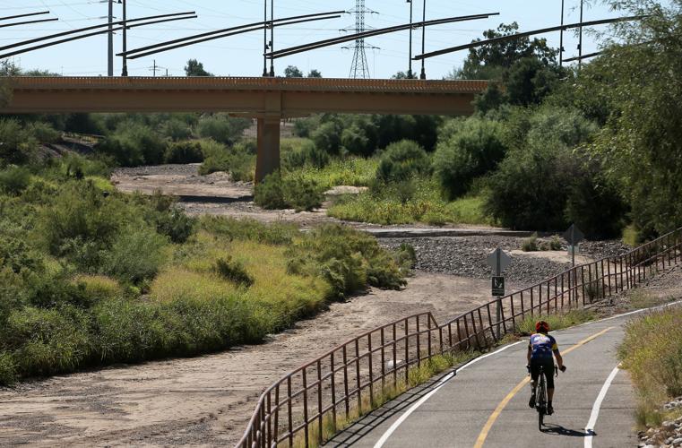
That makes rain even more critical for warding off a scary fire season in Southern Arizona, said Crimmins.
Looking forward, a return to neutral sea-surface temperatures in the Pacific is expected by early summer. The effect of such things on our monsoon is unclear.
There is also a 50 percent chance of a La Niña effect developing in the fall, according to the Climate Prediction Center. That means a cooler ocean and reduced chances for rain.
Maybe. Maybe not.

